Category:A508 road (England)
Jump to navigation
Jump to search
road in England .jpg) | |||||
| Upload media | |||||
| Instance of | |||||
|---|---|---|---|---|---|
| Location |
| ||||
| Transport network |
| ||||
| Length |
| ||||
 | |||||
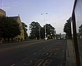
English: The A508 is a short A-class road for north/south journeys in south central England, forming the route from Market Harborough in Leicestershire, via Northampton, to Old Stratford, north-west of Milton Keynes. (→A508 road)

Media in category "A508 road (England)"
The following 20 files are in this category, out of 20 total.
-
 A508 (9982243304).jpg 1,280 × 1,024; 159 KB
-
 A508 (9982296156).jpg 1,280 × 1,024; 231 KB
-
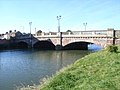 A508 bridge across the river - geograph.org.uk - 1410988.jpg 640 × 480; 83 KB
-
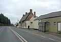 A508 passes The White Hart Public House (geograph 3345421).jpg 3,526 × 2,449; 1.02 MB
-

-

-

-

-
 London Road cycle path - geograph.org.uk - 535347.jpg 640 × 427; 65 KB
-

-
 Rockingham Road railway bridge - geograph.org.uk - 579757.jpg 640 × 456; 90 KB
-
 Stagecoach 37047 YX63 ZWR (11752019094).jpg 4,320 × 3,240; 2.93 MB
-

-
 UK road A508.PNG 568 × 184; 9 KB
-
 White Horse Inn, Kingsthorpe, Northampton.jpg 640 × 480; 74 KB
-
 A508 Lamport - geograph.org.uk - 377157.jpg 640 × 495; 76 KB
-
 A508 northbound - geograph.org.uk - 377172.jpg 640 × 452; 73 KB
-
 A508 northbound - geograph.org.uk - 377197.jpg 640 × 480; 84 KB
-
 Northampton Road in Market Harborough - geograph.org.uk - 580080.jpg 640 × 430; 119 KB
-
 The A508 - geograph.org.uk - 220980.jpg 640 × 480; 77 KB
.jpg)
.jpg)


.jpg)


